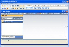
ENVI is the ideal software for the visualization, analysis, and presentation of all types of digital imagery. ENVI’s complete image-processing package includes advanced, yet easy-to-use, spectral tools, geometric correction, terrain analysis, radar analysis, raster and vector GIS. capabilities, extensive support for images from a wide variety of sources, and much more.
ENVI’s unique approach to image processing combines file-based and band based techniques with interactive functions. When you open a data input file, its bands are stored in a list where you can access them from all system functions. If you open multiple files, you can process bands of disparate data types as a group. ENVI’s interactive analysis capabilities include:
Multiple dynamic overlay capabilities that allow easy comparison of images in multiple displays.
Real-time extraction and linked spatial/spectral profiling from multispectral and hyperspectral data that provide you with new ways of looking at high-dimensional data.
Interactive tools to view and analyze vectors and GIS attributes.
Standard capabilities, such as contrast stretching and 2D scatter plots.
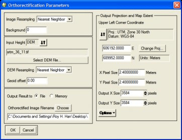
ENVI’s interface is complemented by its comprehensive library of processing algorithms. ENVI includes all the basic image processing functions. ENVI does not impose limitations on the number of spectral bands that you can process, so you can use either multispectral or hyperspectral data sets. ENVI also includes advanced tools for analyzing radar data sets.
ENVI addresses common image processing problem areas such as input of non-standard data types, viewing and analysis of large images, and simple extensions of analysis capabilities (add-on functions). The software includes essential tools required for image processing across multiple disciplines, and it has the flexibility to allow implementation of customized analysis strategies.


Comments (3)
ENVI’s unique approach to image processing combines file-based and band based techniques with interactive functions. When you open a data input file, its bands are stored in a list where you can access them from all system functions. If you open multiple files, you can process bands of disparate data types as a group. ENVI’s interactive analysis capabilities include:
Multiple dynamic overlay capabilities that allow easy comparison of images in multiple displays.
Real-time extraction and linked spatial/spectral profiling from multispectral and hyperspectral data that provide you with new ways of looking at high-dimensional data.
Interactive tools to view and analyze vectors and GIS attributes.
Standard capabilities, such as contrast stretching and 2D scatter plots.
ENVI’s interface is complemented by its comprehensive library of processing algorithms. ENVI includes all the basic image processing functions. ENVI does not impose limitations on the number of spectral bands that you can process, so you can use either multispectral or hyperspectral data sets. ENVI also includes advanced tools for analyzing radar data sets.
ENVI addresses common image processing problem areas such as input of non-standard data types, viewing and analysis of large images, and simple extensions of analysis capabilities (add-on functions). The software includes essential tools required for image processing across multiple disciplines, and it has the flexibility to allow implementation of customized analysis strategies.